Infra
‘Something you’d see in a hurricane:’ Toronto saw more than a month’s worth of rain in three hours

In the span of three hours, Toronto was hit by three thunderstorms, bringing a record amount of rain that caused massive flooding across the city, according to a senior meteorologist with Environment Canada.
“July is typically the second rainiest, second wettest month. Well we had 25 per cent more rain in three hours than we’d have normally in the whole month of July with all the thunderstorms and systems that moved through,” Meteorologist Dave Phillips said in an interview with CP24 Tuesday afternoon.
This aerial image shows vehicles that were abandoned on the Don Valley Parkway amid flooding on July 16. (CP24)
According to Environment Canada, Toronto usually sees 71.6 millimetres of rain for the whole month and Phillips said 96 millimetres of rain was already recorded at Toronto Pearson Airport as of 2:30 p.m. The storm also broke the previous rainfall amount for July 16 documented in 1941, when 25.9 millimetres of rain fell.
“Three thunderstorms in three hours with heavy rains. Now, in a thunderstorm, you can sometimes get no rain. It can thunder and lightning but no rain, or you can get a little bit of rain, but these were like gully washers just one hour after hour,” Phillips said.
“This is a record for this day. I’m never impressed by the amount of breaking records on a day, but the previous record for this day, July 16, was only a quarter of what we saw today in three hours.”
FOLLOW LIVE: WIDESPREAD FLOODING ACROSS THE GTA, NUMEROUS ROADS CLOSED
Phillips described Tuesday’s weather system as a “freight train” that lined up from London, Ont. right through the west of Toronto. He said it moved slowly in a straight line with a pipeline of moisture from the Gulf of Mexico.
It began just before 9 a.m. and lasted until around 1 p.m. Several weather advisories, including severe thunderstorm warning and rainfall warning, were issued as the system moved through the region.
“In fact, what tells me how intense it was — we saw maybe 30 millimetres in 30 minutes, which is something you’d see in a hurricane, but the amount of rain, you could tell it was heavy because of the visibility. We went from 16 kilometre per hour in terms of visibility down to less than two,” Phillips said.
“It was hard to see across the street because the rain was so intense. It was like a blizzard of rain coming down, and you couldn’t see it.”
The torrential downpour resulted in flooded highways and roads, transit services being disrupted and hundreds of thousands of hydro customers without power.
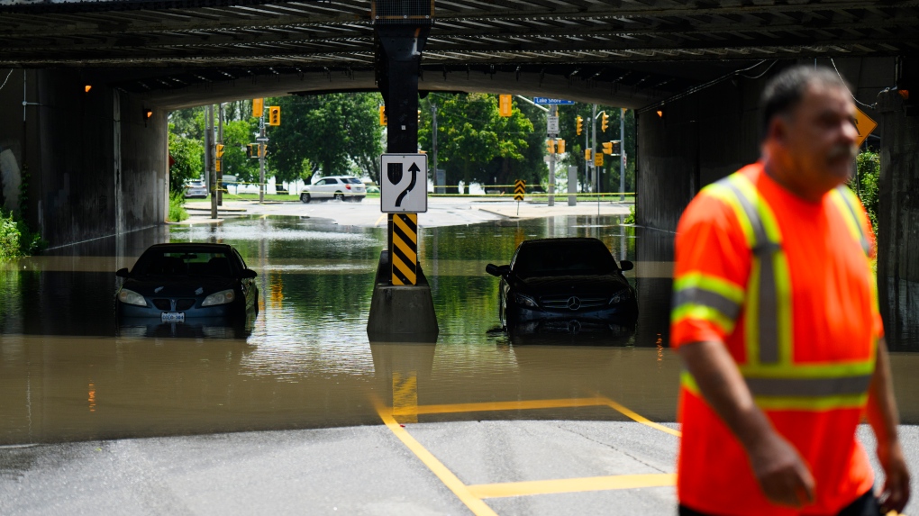
 A tow truck operator responds to submerged vehicles at an underpass at Parkside Drive and Lake Shore Blvd., after heavy rain caused flooding, in Toronto on Tuesday, July 16, 2024. THE CANADIAN PRESS/Christopher Katsarov
Phillips said the city was already well “watered” before Tuesday’s storm as it’s been a wet spring and early summer. He noted that the Toronto area has received 66 per cent more rain than it normally would get this season.
However, Phillips also attributed the flooding to the city’s infrastructure.
“It was overworked,” Phillips said. “We’re a different city. I mean, 20, 30 years ago, there was more green space. You could handle that.”
“Toronto is different than it was decades ago and the city is a different fabric, a different look and so these little garden variety thunderstorms if they do occur can produce really huge amounts of water in a short period of time.”


