Infra
Downpours could last until Thursday as Hurricane Beryl’s remnants hit Ontario

The Greater Toronto Area (GTA) is in for a soggy day as the remnants of Hurricane Beryl sweep through much of southern Ontario, bringing with it heavy rainfall.
Environment Canada said “torrential downpours” are expected in the region as the storm system passes through Wednesday and Thursday. Some areas could see local rainfall amounts of 40 to 60 mm, with rates of 20 to 40 mm/h at times.
The strongest rainfall is expected Wednesday.
CP24 Meteorologist Bill Coulter said most of the GTA will see about two weeks’ worth of rain in a day, while some areas in the north GTA could see a month’s worth. However the storm will come in gaps, consistent with the breakup of a hurricane.
“So instead of having this perfectly round shape that you saw in the Caribbean, it’s been stretched out. It’s taking on post-tropical characteristics. So it’s got kind of these branches and arms of precipitation,” Coulter said.
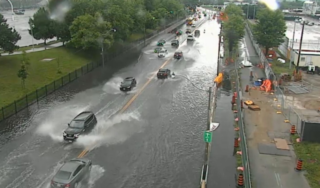
Heavy rainfall is expected in Toronto on Wednesday as the remnants of Hurricane Beryl hit Ontario. (Chris Fox/ CP24)
“So you’re going to look at very light precipitation till about 11:30 a.m., then it returns – another round of showers and storms. Then you get a longer gap through the afternoon, and it returns in the early evening with showers and storms.”
Roads seeing some flooding
Ponding was reported on a number of busy roads around the city Wednesday morning amid the downpour. Cars could be seen driving through about a foot of water on stretches of Lake Shore Boulevard.
 Cars make their way along a flooded stretch of Lake Shore Boulevard in downtown Toronto amid a heavy downpour Wednesday July 10, 2024.
“Heavy downpours can cause flash floods and water pooling on roads. Localized flooding in low-lying areas is possible,” Environment Canada warned. “If visibility is reduced while driving, slow down, watch for tail lights ahead and be prepared to stop.”
The Toronto and Region Conservation Authority issued a flood watch because of the heavy rainfall, saying that shorelines, rivers and streams within the GTA “should be considered dangerous as this rainfall will result in higher flows, rapidly changing water levels, and unstable riverbanks.”
People are being advised to exercise, extra caution around bodies of water, especially with children and pets.
Storm cuts heat wave
Berryl’s remnants blew away a hot air mass which had been sitting over the city for several days, ending a heat warning that had been in place for the city.
In terms of temperature, a high of 23C is expected in Toronto today.
The rain is expected to last into early Thursday morning before tapering off. Thursday’s expected to be cloudy with a high of 24 C.
Sunshine and higher temperatures are expected to return for the weekend, with a high of 28C on Friday and 29 C Saturday.

Toronto Santa Claus Parade organizers ‘optimistic’ after funding comes in for 2025 event

BREAKING: Supreme Court nullifies National Lottery Act

Toronto food bank says crisis is being ignored by those in power | CBC News

Toronto group to hold two holiday events

Grants to help Toronto students explore sciences

Injured cyclists can’t sue province under amendment to new Ontario bike lane bill, NDP says | CBC News

Renderings show planned massive redevelopment at former Toronto Coach Terminal site

City of Toronto considers retrofitting all heavy-duty trucks with side guards – Truck News

Taylor Swift’s motorcade spotted along Toronto’s Gardiner Expressway
